
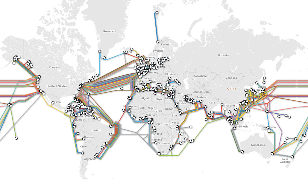
The Submarine Cable Map, just in case you wanted to know where your bits are going. Here’s an excerpt from the description of the site:
TeleGeography’s free interactive submarine cable map is based on our authoritative Global Bandwidth research, and depicts active and planned submarine cable systems and their landing stations. Selecting a cable route on the map provides access to data about the cable, including the cable’s name, ready-for-service (RFS) date, length, owners, website, and landing points. Selecting a landing point provides a list of all submarine cables landing at that station.
The source is available too.